
Collinsville Neighbors by Official Source
No single public file provides a sound list of everyone on a Collinsville block. The parcel map shows land units and spatial relationships. The assessor ties each parcel to an owner for tax purposes. A recorder index identifies parties to dated land instruments. Voter files serve election administration and carry strict limits. Community maps show program areas, not private households.
| Official source | What it shows about a block | Access route |
|---|---|---|
| Madison or St. Clair GIS | Parcel shapes, roads, districts, adjacent PINs | Public online viewer; county office fallback |
| County assessor | Owner, site address, mailing address, tax context | DEVNET portal; assessment counter or request |
| County recorder | Grantor, grantee, document date and parcel link | Remote index, workstation, mail or email copy route |
| Madison voter lists | Date-specific registration and district fields | Official CSV, restricted to bona fide political use |
| City neighborhood map | Service-program area and participating departments | City GIS and Community Development contacts |
These records support different statements. A named owner may not occupy the parcel. A deed party may never have lived there. A registration row is date-specific. Keep those distinctions visible when researching Collinsville neighbors.
Collinsville Blocks Cross County Systems
Collinsville spans Madison and St. Clair Counties. A city or ZIP label does not select the correct records office, because the broad 62234 mailing area also exceeds city limits. Confirm the county through a parcel or GIS result before collecting nearby lots. Then stay within that county's numbering and source system.
Madison County DEVNET accepts a parcel number, owner, site-address range, city, mailing address, ZIP, sales details, tax years, township, class, district, and land use. The St. Clair parcel inquiry is the parallel path east of the county line. Madison PINs can contain 15 to 18 digits; St. Clair recorder searches use a different parcel format. Never transfer one county's number into the other county's form.
Note: Record the county, PIN, map link, source date, and address as printed for each lot before comparing a Collinsville block.
Map a Collinsville Block Outward
The safest block method starts with one verified address and expands only to parcels that touch or face it. The Madison County GIS viewer supplies map context, while the Collinsville public GIS portal adds city layers. A parcel is a mapped unit of land; its PIN is the county's index number for that unit.
- Normalize the starting address, including direction, street type, unit, city, ZIP, and county.
- Find its parcel and record the PIN, map date, road, district, and parcel status.
- Click the lots beside, behind, and across from it, recording only the facts needed for the question.
- Open each matching assessor entry to distinguish site address from owner mailing address.
- Use the Collinsville street directory only when the question expands beyond the immediate block.
A GIS outline is not a legal survey. It shows spatial context and helps select records. Boundary disputes require the recorded plat, legal description, and qualified professional review.
Collinsville Neighbor Voter Limits
The Madison County Voter Lists portal exports district, township, and precinct files. Research found name and registration-address components, political subdivisions, and four voting-history fields. The county notice bars commercial solicitation or business use and limits the data to bona fide political purposes. It is not a general neighbor directory.
The assigned screenshot records the official export surface.
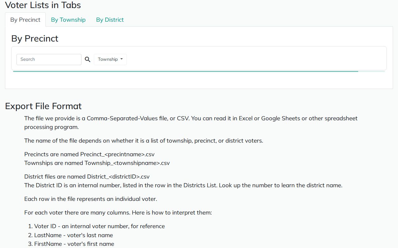
The image provides the county source, but it does not authorize copying a block's voters into a public list. Illinois rules also govern redaction and distribution of phone, Social Security number, street number, birth date, identifiable email, and other sensitive fields.
Collinsville Neighborhood Improvement Areas
The Collinsville Neighborhood Improvement Program divides the city into GIS-based areas. Community Development coordinates Code Enforcement, Building and Zoning, Police, Street, Fire, and Parks work. The program seeks resident feedback and tracks appearance, function, and service needs.
Program contact
Travis Taylor
City extension 1120
Neighborhood Improvement Program
Program contact
Caitlin Rice
City extension 1138
Neighborhood Improvement Program
City record route
City Clerk and FOIA Officer
125 S Center St
618-346-5200
The actual area labels did not appear in the text-only research. Do not invent names. Uptown is a civic and commercial area, East Central is a historic district, and St. Louis Road and Collinsville Road are corridors. Those labels are not interchangeable with a formal neighborhood.
Historic Collinsville Blocks on Two Maps
The 1898 Library of Congress Sanborn map has four sheets, while the 1915 University of Illinois item has 16. That change in scale makes them useful for block context. Start with the key sheet, identify the street and block, then preserve the sheet number, house number, construction label, and map date. A map label describes the built place, not a current person.
Coal and industrial growth shaped Collinsville's older street pattern. The city records mining from 1859 and the Lumaghi Mine from 1869. Historic sheets can explain why a modern parcel shape or street line looks odd, but a dated directory, deed, newspaper, or probate reference is needed to connect a name to that place.
East Central's formal historic district and the city's inventory of 40 landmark sites add civic context. They do not create a roster of Collinsville neighbors. Use the preservation record for landmark status, design review, and dated property history.
Official Collinsville Rolls Versus Tools
Commercial neighbor tools may merge old addresses, phone data, and scraped names without showing why the match was made. Official systems are narrower, but each one identifies its custodian and record purpose. The best result keeps the original identifier and date rather than building a broad personal profile.
| Source type | Strength | Limit |
|---|---|---|
| County parcel and GIS | Known custodian, parcel and map identifiers | Owner and geometry do not prove occupancy |
| Recorder index | Dated instrument and document number | Party name does not prove residence |
| City program map | Official area and service context | No household roster |
| Commercial category | Broad name aggregation | Source, date, and accuracy may be unclear |
When an online county portal fails, call or visit the assessor or recorder. Madison and St. Clair recorder offices also provide public-counter or workstation routes, and exact document identifiers can support mail or email copy requests.
Collinsville Neighbors and Public Licenses
A state professional license can verify a credential only when that fact fits the question. The Illinois Department of Financial and Professional Regulation lookup offers the official route. IDFPR publishes credential status and printable results, but the research says it does not expose a licensee's home contact fields.
The second assigned neighbor image shows the state lookup interface.
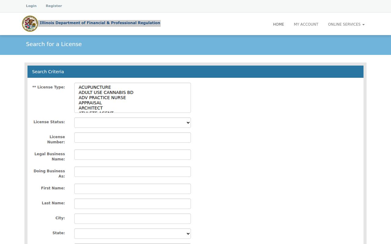
A license result should remain a credential fact. Do not use an office or practice address to infer that someone lives on a Collinsville block. For a correction or certified record, contact IDFPR rather than changing the result yourself.
Protect Privacy of Collinsville Neighbors
Public access is not permission to republish a household profile. Recorded documents may redact personal information. Courts can seal files, and juvenile records are not a general name source. Utility and delivery records are not part of an official block directory. Limit the final note to the fact needed, plus the source, record date, and identifier.
Illinois's Address Confidentiality Program provides a substitute address for qualifying survivors. Agencies must accept it for new records within program limits. Old files are not erased automatically, and property records are not guaranteed to be hidden. Never work around a substitute address or redaction.
Source dates matter on a changing block. DEVNET displays an update stamp, recorded deeds carry filing dates, and voter data reflects its own election system. Keep those dates beside each observation. A later sale, corrected assessment, annexation, or map update can change the official picture without making an older record false. When two records conflict, report the difference and ask the custodian for the current status instead of combining fields into a new profile of Collinsville neighbors.
Lawful use. Research Collinsville neighbors for civic curiosity, reconnecting, or personal safety, never to watch, intimidate, stalk, harass, or harm anyone.
Note: Treat “parcel owner,” “deed party,” “registered voter,” and “resident” as separate claims unless independent official records support the connection.